Bryce Canyon

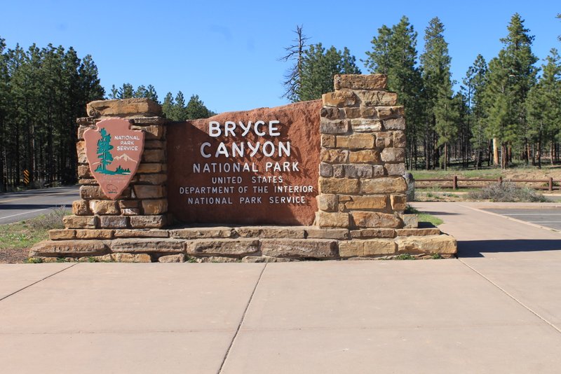
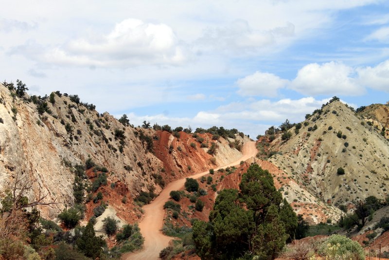
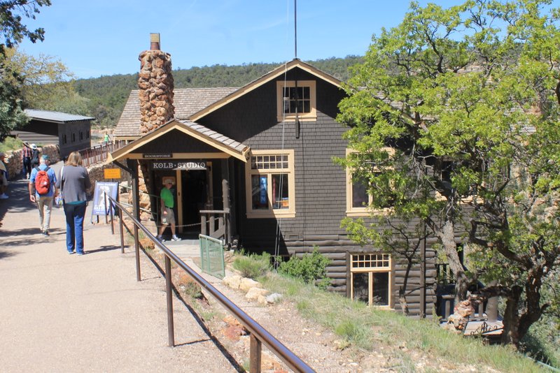
We left Bryce Canyon National Park this morning.

Bryce Canyon National Park


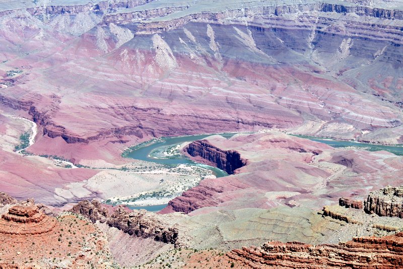
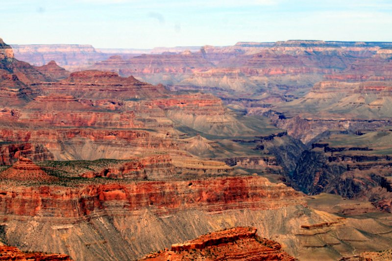
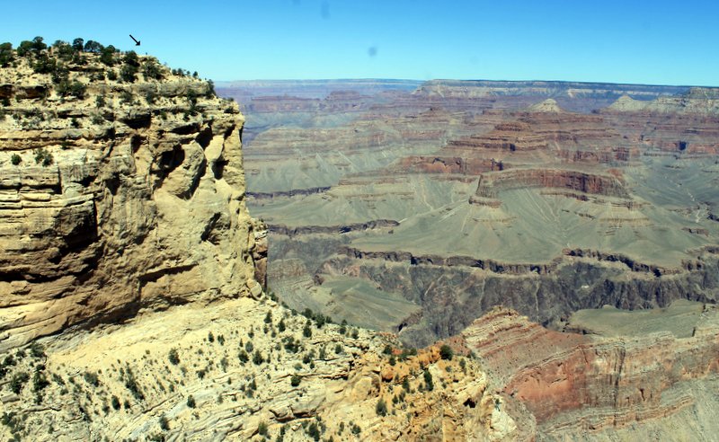
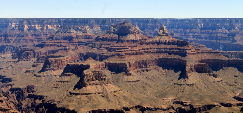
I have seen a lot of breathtaking, beautiful places in the past few years but this is definitely on the top of my list. Bryce Canyon is actually not a canyon but rather the edge of the Paunsagunt Plateau.


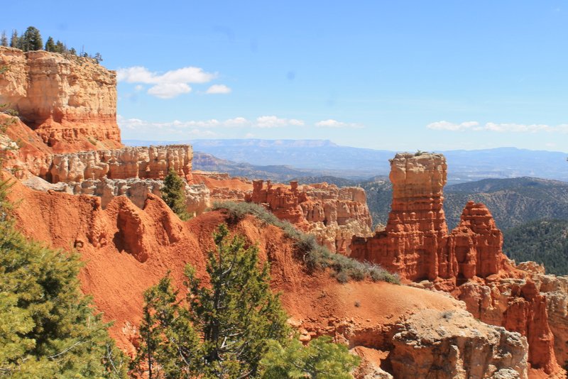
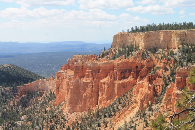
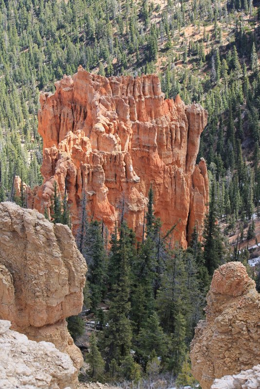
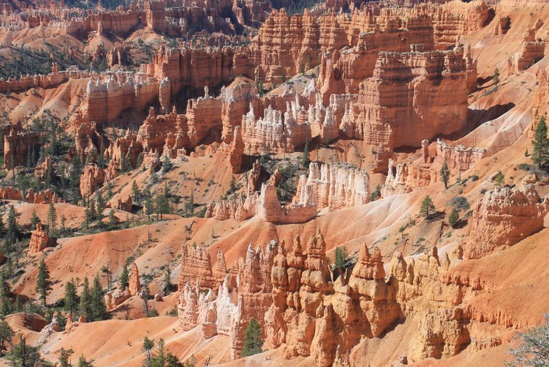
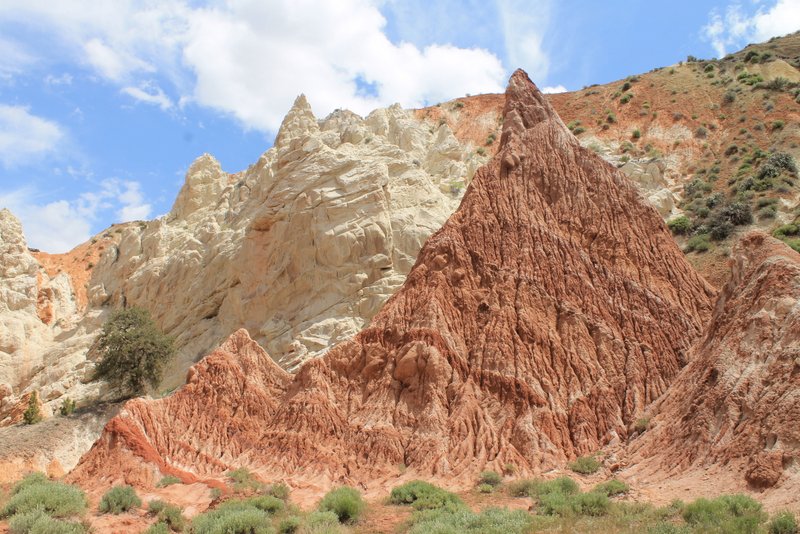
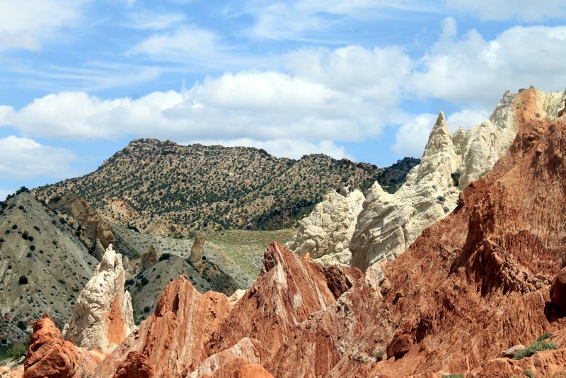
Bryce’s unusual appearance is due to geological structures called  hoodoos that are red, orange and white in color. There is a Paiute Indian legend that says the hoodoos were once bad people that were turned to stone by a coyote. They are known as the Legend People.

Legend People


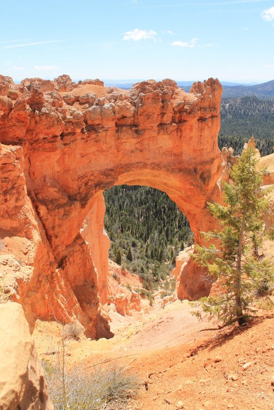
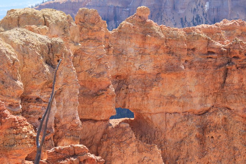
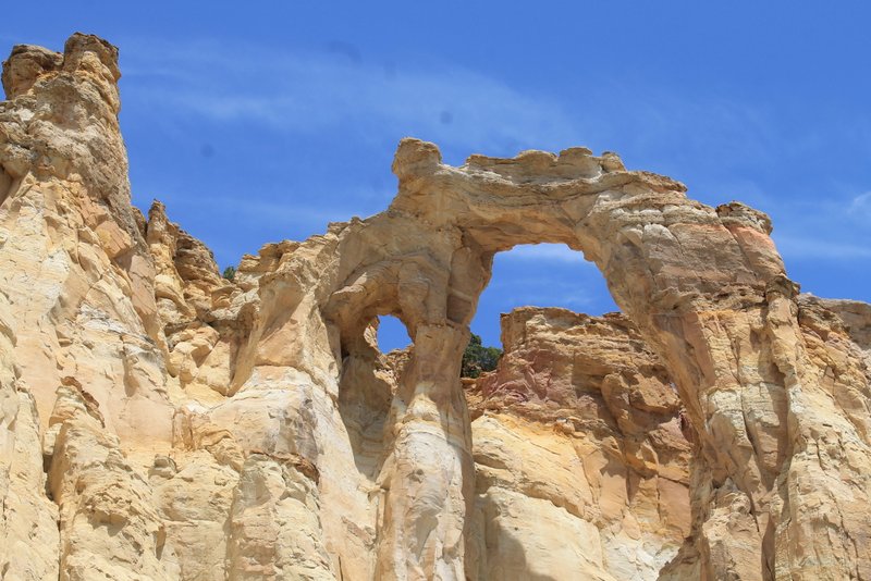
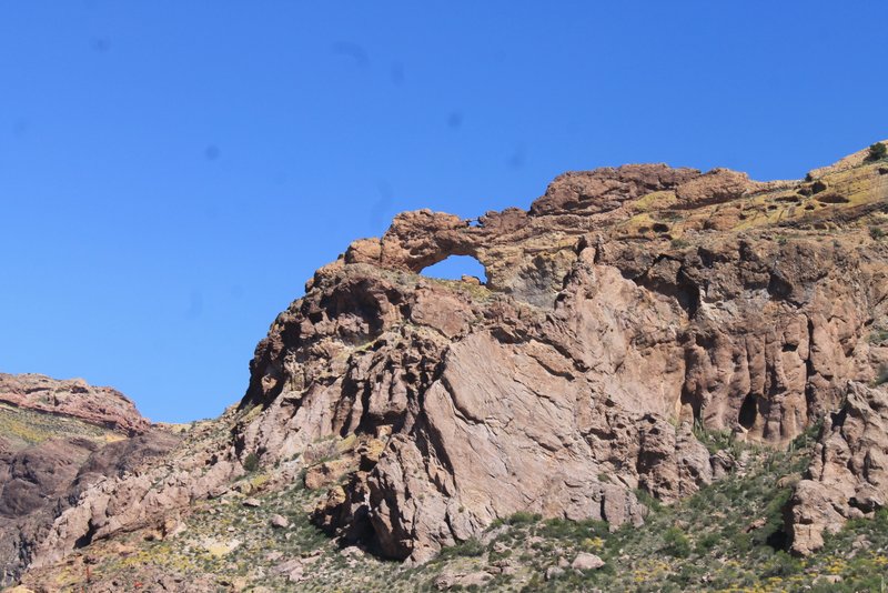
There are a few arches as well as hoodoos.

Natural Bridge


Arch in Bryce Canyon


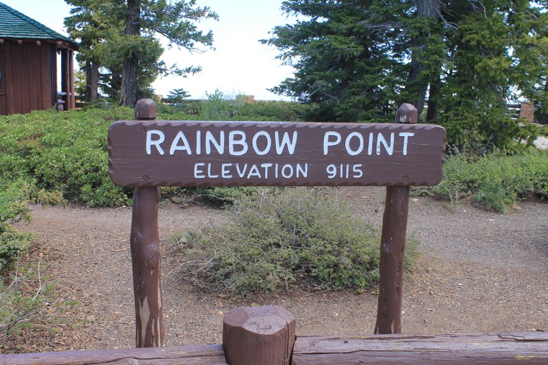
Bryce Canyon is located at high elevation.


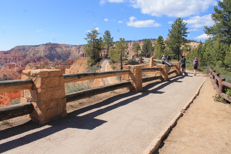
I liked the look of the railings that lined many of the walks and was impressed with how many handicapped accessible areas there were (including some of the popular hiking trails).

Rim Trail Between Sunrise Point and Sunset Point


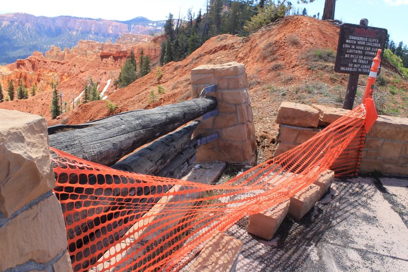
But the erosion continues and some of the nice looking railings will need to be moved back soon!

Falling into Bryce Canyon


Glen Canyon / Lake Powell

We originally planned to visit Zion National Park after Grand Canyon but…. Even though Zion is only about 100  miles from Grand Canyon South Rim as the crow flies it is actually 275 via road (which is a good idea), and due to road restrictions our big motorhome was not able to take the shortest route. We would have had to go west to Las Vegas and then back into Bryce from the west side (well over 400 miles).  So we made an executive decision and decided to skip Zion (we’ve been there before) and visit Lake Powell instead.  We were at Lake Powell a few years ago and enjoyed it. It was good this time around also.

Lake Powell is part of the Colorado River that runs through Glen Canyon. It is held in by the Glen Canyon Dam. We stayed in Wahweap Campground in Glen Canyon National Recreation Area. The campground overlooks the lake.

Lake Powell from Wahweap Campground


One day we took a jeep ride through Cottonwood Canyon, a few miles north of the lake.

Jeep Road in Cottonwood Canyon


Cottonwood Canyon has some spectacular scenery.

Cottonwood Canyon


Cottonwood Canyon


Rocks in Cottonwood Canyon


Flowers in Cottonwood Canyon


Flowers in Cottonwood Canyon


Cottonwood Canyon runs through Bureau of Land Management (BLM) land which is often leased to ranchers and farmers. So we met some friends on the way.

Cows in the road in Cottonwood Canyon


Grosvenor Arch is a really cool double arch in the Canyon. It is named after Gilbert Grosvenor, a photojournalist who was an editor of National Geographic magazine and president of the National Geographic Society.

Grosvenor Arch


The following day we took to the water in our kayaks.

Kayaks on Lake Powell


Lake Powell


Lake Powell

Grand Canyon

Last week we were in Grand Canyon National Park. It is an amazing a beautiful place.

We stayed at Trailer Village Campground in the park.  A herd of elk wanders through daily.

Elk in our campsite at Trailer Village


We were visiting the south rim which has lots of historic locations to explore.

The Desert View Watchtower is at the east end of the park. The watchtower holds special interest for me because it was designed by Mary Colter. Mary Colter was one of the few female architects of the early 1900s. She designed many of the buildings in Grand Canyon. Most of her Grand Canyon buildings were designed in a Native American style.

Desert View Watchtower


Desert View Watchtower


Petroglyph Mural in Desert View Watchtower


Ceiling Art in Desert View Watchtower


Desert View Watchtower From a Distance


At the west end of the park is another Mary Colter building, Hermits Rest. This building is named for Louis Boucher who lived alone at that location for many years. It is designed to appear like natural stone, blending with the landscape.


Hermits Rest


Stone Arch at Entrance to Hermits Rest


Hopi House is another Mary Colter building in the Grand Canyon historic village. It is designed to resemble a Hopi Pueblo. It was built to market Native American Crafts to visitors staying at the nearby El Tovar Lodge.

Hopi House


The Kolb Brothers were adventurers and photographers who published many famous photos of Grand Canyon.  Their studio was on the rim and was NOT designed by Mary Colter 🙂

Kolb Studio


And, of course, aside from the history and architecture there are magnificent views.

Colorado River in Grand Canyon


Wow!!


They say you should put people in photos of Grand Canyon for perspective. There are people in the upper left corner.


Grand Canyon

Colorado River

While in Arizona we stayed in Yuma, Parker, and Lake Havasu City – all on the Colorado River. Below are some photos of the river.

Beach at Sundance Campground in Earp, CA


Kayaking on Colorado River in Parker


London Bridge at Lake Havasu on Colorado River


Colorado River at Buckskin Mountain State Park


Shuttle that runs between campgrounds (Pirates Den in Parker, AZ and Sundance in Earp, CA)


Sunset over Lake Havasu


Kayaking in Parker


Sunset in Lake Havasu State Park


South-Western Arizona History

We have been in south-western Arizona for the past month.  Arizona has many historic locations.

While we were in Yuma we visited the Yuma Quartermaster Depot State Historic Park. At this location supplies (food, clothing, ammunition) was stored for US Army forts in the Southwest.

Quartermaster Depot


Quartermaster Depos


Quartermaster Depot


Yuma is also the location of historic Yuma Territorial Prison. All the Arizona bad guys in the late 1800s were jailed at this prison.

Yuma Territorial Prison


Yuma Territorial Prison


Yuma Territorial Prison


Yuma Territorial Prison


Yuma Territorial Prison


Tombstone Arizona was one of the Wild West boom towns. Silver mines allowed the town to grow and prosper during the late 1800s.  It was also the location of the famous gunfight at the OK Corral.

OK Corral Gunfight Re-enactment


Crystal Palace in Tombstone


Tombstone


In 1958 Robert McCulloch (of McCulloch chainsaws) purchased a bunch of land on the shore of Lake Havasu along Pittsburgh Point. This area became Lake Havasu City in 1963.  Between 1968 and 1971 the London Bridge (actual bridge that crossed the Thames River in London) was disassembled, shipped to Arizona and re-assembled in Lake Havasu city. A canal was dug transforming the Pittsburgh Point peninsula into an island and the reconstructed bridge crosses that canal from the mainland to the island.

London Bridge


Another part of Arizona history is historic route 66. Oatman, AZ is an old mining town on route 66.  Due to the mining history of this area there are large numbers of wild burros, descendants of the burros that were used for mining operations.

Wild Burros in Oatman


Burro in Oatman

Blooming Desert Parks in Southwest

During the past month we visited a number of national parks in the desert southwest: Big Bend National Park in Texas, Saguaro National Park in Arizona, and Organ Pipe Cactus National Monument in Arizona.  We lucked out with timing of these visits. There was an unusually high amount of rain over the winter which has made the desert turn green with an abundance of wildflowers.

Barrel Cactus and Wildflowers


Brittlebush


Brittlebush


Hedgehog Cactus


Creosote Bush


Saguaro Cactus


Crazy Looking Saguaro Cactus


Organ Pipe Cactus


Fish Hook Cactus


Ocotillo Flower


Ocotillo (Ocotillo is actually not a cactus – it is candlewood)


Torrey Yucca


Prickly Pear Cactus


Prickly Pear Cactus


And the landscape that is so different from the northeast is spectacular.

The Window in Big Bend


Saguaro National Park


Arch in Organ Pipe Cactus National Monument


On the Road in Arizona


Organ Pipe Cactus National Monument


Desert View Hiking Trail in Organ Pipe Cactus National Monument


Sunset at Our Campsite in Twin Peaks Campground (Organ Pipe Cactus National Monument)


View from our campsite in Terlingua, TX (Near Big Bend National Park)


Rio Grand River – Big Bend National Park


Santa Elana Canyon (Big Bend)


Not Snow – Just White Rocks


Mule Ears – Big Bend


South Padre Island

We were on South Padre Island, Texas for the two weeks. We left this past Wednesday. South Padre Island is a barrier island on the gulf coast of Texas and is very far south, close to Mexico.  We did not like it as much as Mustang Island. South Padre is more populated (lots of hotels and skyscrapers) and the beaches in many places are full of trash (very sad).

We were there during Spring Break Week and we had been told by numerous people that the Island would be overrun with college students and we would not be able to drive anyplace due to gridlocked traffic. When we arrived at our campground some of the neighbors said they were leaving early to avoid the Spring Break “chaos”. We did see a number of college students and a slight increase in traffic but probably would not even have noticed if we did not hear the dire warnings from friends.

We were hoping to do some 4-wheeling on the beach as we did on Mustang Island and Padre Island National Seashore, but the tides and weather were against us. On the beaches where 4-wheeling is normally done the water was so high it almost touched the dunes – even at low tide. The sand that was uncovered was soft and deep – easy to get stuck. So we did not drive on the beach but we found other things to do.

Nature Center

We visited the South Padre Island Birding and Nature Center.

Pretty Waterfall at Entrance to South Padre Birding & Nature Center


Love Those Feet !!!


Osprey


Dolphins & Doggy

We went on a dolphin tour. The tour was on a small pontoon boat with a great skipper and a small dog who communicates with the dolphins. It was a beautiful day for a boat ride and we saw lots of dolphins.


Notice the small black fin of a baby dolphin behind mama.


ISLA BLANCA STATE PARK

We stayed in the Isla Blanca State Park Campground. We had a site close to the beach.

Our Site at Isla Blanca


Picnic Pavilion at Beach – always full of nasty seagulls


Jesus is watching over the campground 🙂


Communication tower knocked down sometime before we arrived. Note the red light on top is still working.


Fishing Jetty in Isla Blanca Park


Happy Birthday

And we celebrated Bill’s birthday.


Shipwreck on Mustang Island

We saw this one day on the Mustang Island beach. Apparently the skipper fell and hit his head then was airlifted for medical attention. We heard conflicting stories about where the accident occurred – one version said he ran aground right off Mustang Island, another said the accident occurred near Port Isabel and the boat drifted up to Mustang.  Nevertheless the guy is OK and the boat was removed from the beach two days later.

Shipwreck on Mustang Island


Kayaking in Corpus Christi Bay

As usual, we have our kayaks with us. One day while still on Mustang Island we took the kayaks over to Wilson’s Pass on the bay side of the Island.  The route we selected seemed typical for us. We saw some wildlife and had lunch on a small island.  But on the way back the wind picked up and for the first time ever I was not sure I could paddle back to our starting point against the wind. We noticed a dirt road by the edge of the water that we thought would lead back to the place where we parked the jeep. So I pulled my kayak out onto the shore while Bill paddled the last mile or so by himself so he could drive the jeep out to where I was waiting. Turns out that some of the “road” was nearly under water and very mucky. Luckily we have a 4-wheel drive and an excellent driver, otherwise: who knows!!! He did make it out to me with a very muddy jeep and we found another way back to the main road.


Getting Ready to Kayak Out Wilson’s Cut


Beach in Laguna Madre (aka Corpus Christi Bay)


Spoonbill in Wilsons Cut


Pelicans


Bill to the Rescue (My Hero!)

Port Aransas Ferry and Rockport

There is a boat channel at the northern end of the Mustang Island – an entry into Corpus Christi bay.  There is a free ferry run by Texas DOT to cross the channel. One day we  took the ferry and then drove up the coast a bit to Rockport, TX. Rockport is a cute little coastal town with an ‘artsy’ flavor.


Driving onto the Ferry in Port Aransas


Where’s the Road?


Oil Rigs in Port Aransas as seen from the Ferry


Famous Crab Sculpture in Rockport